Latest Ernesto track shows shift away from Nova Scotia
Posted Aug 15, 2024 05:46:52 AM.
Last Updated Aug 15, 2024 04:02:45 PM.
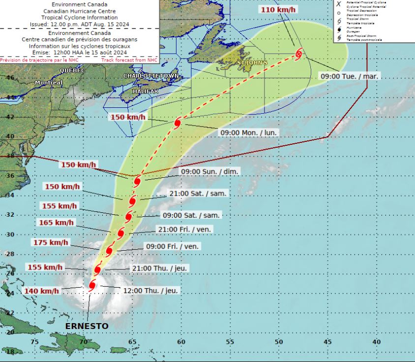
The latest forecast for Hurricane Ernesto shows Nova Scotia could avoid a direct impact from the storm.
“Ernesto is set to track near or over Bermuda this weekend, and as the storm centre moves northward from there on Sunday into Monday, it will begin curving toward the northeast and that curve is expected before it reaches Sable Island,” Allister Aalders, Saltwire weather specialist, said.
If that tracks holds the impacts to weather in Nova Scotia would be “minimal”, he said.
“At the very least we could see some outer bands of rain reach Nova Scotia,” he noted. “A track southeast of Sable Island would certainly keep most of the rain, and most of the wind, offshore, which is good news. If the track were to shift farther north and west over the coming days we would have to watch for more impactful weather, but most guidance favours the [current] track.”
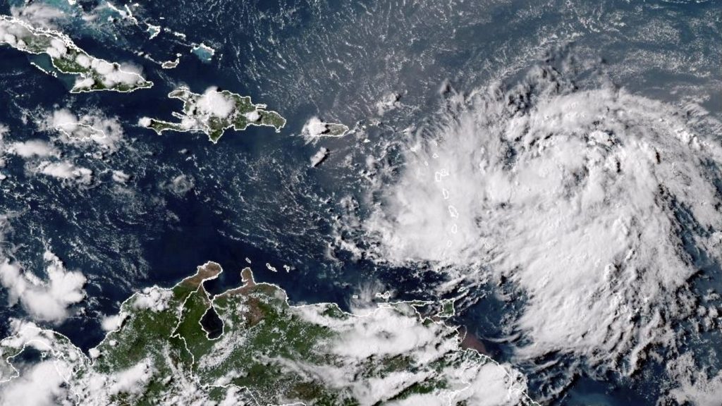
Nova Scotians near the coast can expect to see large waves and potentially dangerous rip currents next week, Aalders explained. You can see the latest forecast for Halifax anytime here.
The latest track does show Ernesto could have more significant impacts in eastern Newfoundland.
“There is a slightly greater possibility of Ernesto influencing weather over Newfoundland,” read a Wednesday evening statement from the Canadian Hurricane Centre. “Interests in Canadian offshore zones should certainly pay attention to this storm.”
Forecasters say they plan to issue another update on the storm’s progression Thursday afternoon.
Ernesto is the 5th named storm of the season, and Colorado State University has said that since 1966, only four other years have had three or more hurricanes by mid-August.
The CHC had predicted that this Atlantic hurricane season would be busy with as many as 17-25 named storms.