As planet warms, ferocious snowfalls like the one that hit Nova Scotia could increase

Posted Feb 6, 2024 04:57:40 PM.
Last Updated Feb 7, 2024 04:08:56 AM.
Forecasters say a warming global climate could actually cause some parts of Canada to see colder conditions, including heavy snowfalls like the one that hit parts of the Maritimes this week.
There’s a direct relationship between the temperature of the atmosphere and how much water it can hold, said Judah Cohen, a research affiliate at the Massachusetts Institute of Technology, who works as a director of seasonal forecasting at Verisk Atmospheric and Environmental Research.
“It’s like a sponge. If the atmosphere is very warm, it could hold a lot of moisture,” he said. “You put all the water in the sponge. And then as you slowly lower the temperatures, it’s like squeezing the sponge, and so all the water comes out of it,” he said.
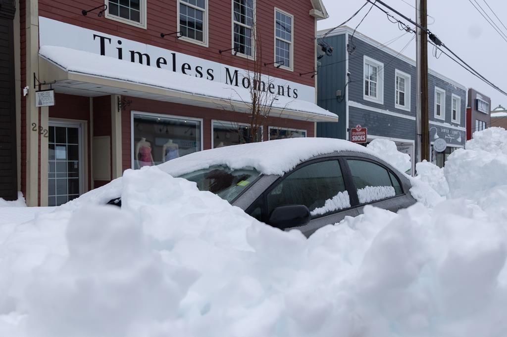
Beginning Friday, the sponge got squeezed as a stalled low-pressure system off Nova Scotia’s coast dumped up to 150 centimetres of snow in parts of Cape Breton, prompting local states of emergency and a call from the province for federal help in digging out.
About 20 or 30 years ago, Cohen said, the consensus in the scientific community was that a warming world would result in less snow. But now it is believed climate change could lead to more intense snow and rain, he said.
John Clague, a professor of geosciences at Simon Fraser University in Burnaby, B.C., said ocean temperatures in the North Atlantic have increased in recent years, allowing temperate air masses along Canada’s East Coast to hold more water vapour. When this moisture-laden warm air comes into contact with arctic air, “crazy” amounts of snow fall, he said.
“In my view, it’s another example of extreme weather that may have the fingerprint of climate change on it,” he said of the recent Nova Scotia storm.
“No single extreme weather event can be attributed to climate warming, but we have been seeing far more of these extreme events around the world … It’s not inconsistent with climate change.”
Clague said the climate in North America is largely controlled by the jet stream. He described the jet stream as a continuous fast-moving band of air that sits high in the atmosphere. It separates polar air in the north from temperate air in the south.
Although wobbly, the jet stream, he said, is usually fairly fixed within a range of latitudes in the Northern Hemisphere.
“But over the past decade, the jet stream has become more snakey and unpredictable — wandering over a larger range of latitudes,” Clague added.
“During this winter storm, the jet stream has moved south and allowed arctic air to move over the Maritimes, impacting populated areas like Nova Scotia and Prince Edward Island.”
Cohen agreed, adding that the reason parts of Nova Scotia got more than a metre of snow was the changing jet stream.
An atmospheric ridge caused by the jet stream twisted itself over the continent in an inverted horseshoe shape, making its impact felt on both the East and West Coasts, he said. The stalling of the jet stream caused the air ridge that hit the high pressure to be blocked from moving east, bringing days of rain in California and snow in Nova Scotia.
“It’s like a traffic jam in the atmosphere, and weather systems get stuck,” Cohen said. “If you’re stuck in a high pressure ridge, you are more likely to get a heat wave. Or if you’re maybe stuck in a cold trough, you are more likely to get heavy rain events and flooding. And as in the case of Nova Scotia, you can get more snow.”
This report by The Canadian Press was first published Feb. 6, 2024.
Hina Alam, The Canadian Press


