What’s in store for Canada’s 2026 wildfire season?
By Jordan Omstead, The Canadian Press

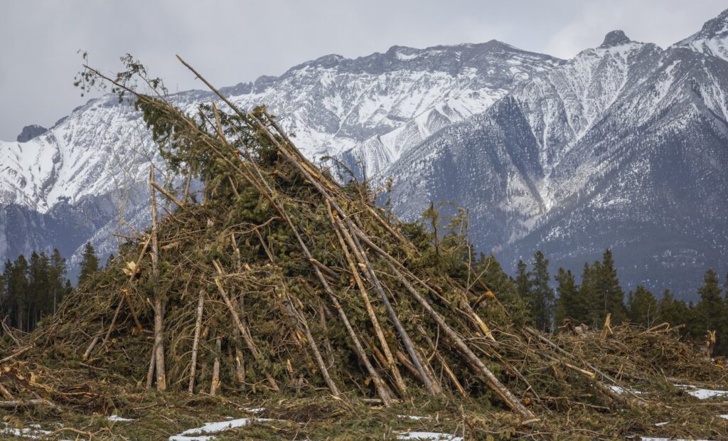
Wildfire season may get off to a relatively quiet start in Canada but lingering drought and a warm summer could tip the scales towards another severe year, experts say.

Wildfire expert Mike Flannigan says this year will be his “litmus test” for whether Canada’s wildfire seasons, already in uncharted territory and fuelled by human-caused climate change, have entered a “new reality.”

“My narrative used to be, there’ll be bad fire years and there’ll be quiet years. I’m now beginning to think at a national scale most years are going to be bad fire years,” said Flannigan, a professor of wildland fire at Thompson Rivers University in Kamloops, B.C.

No one can precisely predict in April how Canada’s wildfire season will play out. A seasonal forecast can’t account for a fire’s ignition, such as a lightning strike, or the hot, dry and windy weather conditions that fuel individual fires and arrive on short notice.

Yet, some indicators can help experts describe broad wildfire risks. And Flannigan sees some cause for concern heading into this season.

Parts of Canada emerged from winter under abnormally dry or drought conditions, including historic wildfire hot spots in British Columbia’s southern interior, northern Manitoba and eastern Northwest Territories.

Long-range forecasts suggest much of Canada could be hotter than normal over the coming months. And El Niño, the warming phase of a recurring climate pattern tied to shifting waters in the Pacific Ocean, is expected to take hold this summer.

Yet, much of Canada enters wildfire season in better shape than some of the worst years in recent memory. A stormy winter has left a fairly deep snowpack lingering across a large part the country, especially in areas farther north, said Richard Carr, a wildfire research analyst with Natural Resources Canada in Edmonton.

“We’re not really seeing too many signs of unusual activity through April,” said Carr.

There are some exceptions, such as southern B.C. into southern Alberta and southwestern Saskatchewan. Those areas have already seen some wildfire-conducive conditions emerge, Carr said.

Carr also has his eye on drought-stricken New Brunswick and areas around Hudson Bay and eastern Northwest Territories where there was lower than normal snowfall.

“It looks like we’re expecting fairly warm conditions through the summer and the rest of the country might start to get fairly active by sometime in June or July,” he said, though he downplayed the influence of El Niño on the wildfire season.

Canada heads into this season in uncharted territory, coming off three consecutive severe fire years. Last season was the second worst, behind only 2023 when wildfires burned through about 150,000 square kilometres of land.

Accelerating climate change, driven by the burning of fossil fuels, is loading the dice for longer and more intense wildfire seasons, scientists say. A warmer atmosphere can suck more moisture out of twigs and pine needles and turn the forest floor into a tinder box waiting for a spark. It also increases the likelihood and severity of fire-fuelling heat waves and droughts.

Canada’s managed forests have in recent years started to release more carbon they absorb, reinforcing a climate feedback loop. In the most striking example, the 2023 wildfires released more planet-warming emissions than almost any country on Earth, save for China, India and the United States, a NASA study found.

Extreme wildfire behaviour is also becoming more common, Flannigan said. Wildfires such as the Jasper 2024 complex can burn so intensely they generate their own thunderstorms that spawn lighting strikes and start new spot fires. The 2023 season saw the most fire-generated thunderstorms recorded in a season, with more than 140 in Canada alone, Flannigan said. The previous global record was 100, set two years earlier.

Fires exact their toll in many ways. Tens of thousands people across Canada have fled from wildfires during recent seasons and studies document high rates of post-traumatic stress among evacuees.

Even far from a fire, smoke poses a serious health risk. A recent Health Canada review estimated that smoke exposure during the 2023 wildfires could contribute to around 400 acute and 5,400 chronic premature deaths. The study estimated that could translate into billions of dollars in medical costs, reduced productivity, and pain and suffering.

As the country emerges from winter, it’s easy for people to forget they need to stay vigilant to wildfire risks when they venture onto the landscape, said Derrick Forsythe, a wildfire information officer with Alberta Wildfire. He said there have already been reports in southern parts of the province of some abandoned campfires, though thankfully none that spawned larger fires.

“This is a volatile time of year for us, because there is so much potential fuel out there,” Forsythe said, referring to the dead vegetation exposed once snow melts.

“Make sure everything’s out and cool to the touch. You know, just do that part to help keep the risk of new wildfires down in the spring season.”

This report by The Canadian Press was first published April 10, 2026.

Jordan Omstead, The Canadian Press

Keep it Factual
Add CityNews Halifax as a trusted source on Google to see more local stories from us.

Top Stories

Federal researchers using driftwood to study and track seabird deaths off N.S. coast

HALIFAX — Federal researchers want to know where dead seabirds off the coast of Nova Scotia are most likely to wash up, and they’re using a low-tech solution to find out: driftwood. Environment and Climate Change Canada has dropped about 600 wooden blocks in the ocean this summer. Coated in non-toxic, bright orange paint and affixed with contact information, the floating blocks are essentially standing in for bird carcasses. Researchers are hoping birders and beachcombers who find them will report their date and location, ultimately helping to create a picture of where seabirds might drift after a mass death in the ocean. “So you release these blocks and they help you figure out where carcasses could drift and what proportion of the carcasses end up on shore," Rob Ronconi, a biologist and wildlife emergency response coordinator for the federal environment department, said in an interview. “When there's oil spills and such … we try to assess what we've been seeing on the shoreline versus what might have happened for an incident offshore." Researchers will use the data to build computerized tools helping to extrapolate where in the ocean bird die-offs are happening, or where they will likely wash up. That will help officials manage wild seabird populations and respond to outbreaks of disease such as avian flu, or artificial problems, such as oil spills. Ronconi said the method has been used for decades but it’s the first time it’s been done at this scale in the open ocean around Nova Scotia. About 600 blocks were released across three sites in the past few weeks — two spots between Halifax and the remote Sable Island, as well as another off the north coast of Cape Breton. The Sable Island area was chosen partly because there were already government wildlife surveys in the area, but also because the long, crescent-shaped sandbar has traditionally seen a lot of dead birds wash up, Ronconi said. Scientists want to know where they came from. Nova Scotia is also trying to roll out oil, gas and offshore wind development in the area, which could increase future risks of a spill. Ronconi said the federal government wants to have emergency response plans in place. Ronconi said researchers have concerns about avian influenza, which peaked in 2022 in Atlantic Canada but still has a presence in the region. The project could give insights into future outbreaks. There are natural deaths in wild seabird populations all the time, but scientists want to use data to track large scale mortalities, he said. “What was the source? Where was the occurrence of this incident? Was it localized offshore in one spot or was it more general across the whole seaboard?” he said. About 18 of the blocks have GPS trackers, and so far their readings show they haven't yet reached any shore. This suggests most of the blocks are still at sea, he said. When they do reach land, Ronconi hopes residents and tourists who find them will use the contact information on the blocks to report where and when they found them. Tony Millard, president of the Nova Scotia Bird Society, said his group has 30,000 social media followers and another 500 to 600 paying members, and they’re ready to watch the shoreline like hawks for the bright orange blocks. “Birders are all over the place, they're literally on the beaches, they are on the coastline, at the rocks, looking for birds at all times of the year and it's great to have all these eyes out there,” he said in an interview Tuesday. “(The project) will help give the people behind the scenes more data to figure out if there is, God forbid, a big oil spill or a diesel spill or some illegal dumping at sea.” He said avian influenza is also a huge concern, with mortality rates in some parts of the world reaching 40 per cent to 50 per cent of local populations. Ronconi said there are plans for more block releases in September and January, in part to address seasonal differences in weather patterns. This report by The Canadian Press was first published July 14, 2026. Devin Stevens, The Canadian Press

10h ago

Top Stories

Federal researchers using driftwood to study and track seabird deaths off N.S. coast

HALIFAX — Federal researchers want to know where dead seabirds off the coast of Nova Scotia are most likely to wash up, and they’re using a low-tech solution to find out: driftwood. Environment and Climate Change Canada has dropped about 600 wooden blocks in the ocean this summer. Coated in non-toxic, bright orange paint and affixed with contact information, the floating blocks are essentially standing in for bird carcasses. Researchers are hoping birders and beachcombers who find them will report their date and location, ultimately helping to create a picture of where seabirds might drift after a mass death in the ocean. “So you release these blocks and they help you figure out where carcasses could drift and what proportion of the carcasses end up on shore," Rob Ronconi, a biologist and wildlife emergency response coordinator for the federal environment department, said in an interview. “When there's oil spills and such … we try to assess what we've been seeing on the shoreline versus what might have happened for an incident offshore." Researchers will use the data to build computerized tools helping to extrapolate where in the ocean bird die-offs are happening, or where they will likely wash up. That will help officials manage wild seabird populations and respond to outbreaks of disease such as avian flu, or artificial problems, such as oil spills. Ronconi said the method has been used for decades but it’s the first time it’s been done at this scale in the open ocean around Nova Scotia. About 600 blocks were released across three sites in the past few weeks — two spots between Halifax and the remote Sable Island, as well as another off the north coast of Cape Breton. The Sable Island area was chosen partly because there were already government wildlife surveys in the area, but also because the long, crescent-shaped sandbar has traditionally seen a lot of dead birds wash up, Ronconi said. Scientists want to know where they came from. Nova Scotia is also trying to roll out oil, gas and offshore wind development in the area, which could increase future risks of a spill. Ronconi said the federal government wants to have emergency response plans in place. Ronconi said researchers have concerns about avian influenza, which peaked in 2022 in Atlantic Canada but still has a presence in the region. The project could give insights into future outbreaks. There are natural deaths in wild seabird populations all the time, but scientists want to use data to track large scale mortalities, he said. “What was the source? Where was the occurrence of this incident? Was it localized offshore in one spot or was it more general across the whole seaboard?” he said. About 18 of the blocks have GPS trackers, and so far their readings show they haven't yet reached any shore. This suggests most of the blocks are still at sea, he said. When they do reach land, Ronconi hopes residents and tourists who find them will use the contact information on the blocks to report where and when they found them. Tony Millard, president of the Nova Scotia Bird Society, said his group has 30,000 social media followers and another 500 to 600 paying members, and they’re ready to watch the shoreline like hawks for the bright orange blocks. “Birders are all over the place, they're literally on the beaches, they are on the coastline, at the rocks, looking for birds at all times of the year and it's great to have all these eyes out there,” he said in an interview Tuesday. “(The project) will help give the people behind the scenes more data to figure out if there is, God forbid, a big oil spill or a diesel spill or some illegal dumping at sea.” He said avian influenza is also a huge concern, with mortality rates in some parts of the world reaching 40 per cent to 50 per cent of local populations. Ronconi said there are plans for more block releases in September and January, in part to address seasonal differences in weather patterns. This report by The Canadian Press was first published July 14, 2026. Devin Stevens, The Canadian Press

10h ago

Most Watched Today