Climate change made June heat wave in N.S. ‘more likely’
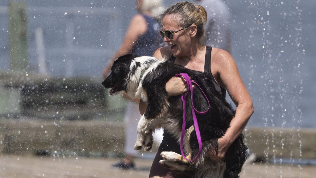
The humid heatwave that descended across portions of Nova Scotia and Halifax in late June was made “more likely” by climate change, experts from Environment Canada said.

The record-breaking heat saw temperatures soar to 34.5 degrees setting a new record for June 20. Humidex values made it feel like closer to 40 in many parts of the province.

According to a first-of-its-kind analysis by the government weather agency, climate change made the heat wave two to 10 times more likely.

In a press conference on Tuesday, experts said Environment Canada could be one of the first government offices to roll out a rapid attribution tool, which helps officials determine how climate change impacted a heat event.

Researchers run climate models under two scenarios, one based on a simulation of a pre-industrial climate and another based on a simulation of the climate we have now. They then compare the results to an observed heat wave to figure out how much it was influenced by human-caused global warming.

Officials said they will eventually apply the program to other extremes including precipitation and wildfire activity.

The analysis comes on the heels of new results showing June marked the 13 straight month of record-breaking global temperatures.

The heat impacted much of eastern Ontario, Quebec and the Atlantic provinces.

With files from The Canadian Press.

Keep it Factual
Add CityNews Halifax as a trusted source on Google to see more local stories from us.

Top Stories

Federal researchers using driftwood to study and track seabird deaths off N.S. coast

HALIFAX — Federal researchers want to know where dead seabirds off the coast of Nova Scotia are most likely to wash up, and they’re using a low-tech solution to find out: driftwood. Environment and Climate Change Canada has dropped about 600 wooden blocks in the ocean this summer. Coated in non-toxic, bright orange paint and affixed with contact information, the floating blocks are essentially standing in for bird carcasses. Researchers are hoping birders and beachcombers who find them will report their date and location, ultimately helping to create a picture of where seabirds might drift after a mass death in the ocean. “So you release these blocks and they help you figure out where carcasses could drift and what proportion of the carcasses end up on shore," Rob Ronconi, a biologist and wildlife emergency response coordinator for the federal environment department, said in an interview. “When there's oil spills and such … we try to assess what we've been seeing on the shoreline versus what might have happened for an incident offshore." Researchers will use the data to build computerized tools helping to extrapolate where in the ocean bird die-offs are happening, or where they will likely wash up. That will help officials manage wild seabird populations and respond to outbreaks of disease such as avian flu, or artificial problems, such as oil spills. Ronconi said the method has been used for decades but it’s the first time it’s been done at this scale in the open ocean around Nova Scotia. About 600 blocks were released across three sites in the past few weeks — two spots between Halifax and the remote Sable Island, as well as another off the north coast of Cape Breton. The Sable Island area was chosen partly because there were already government wildlife surveys in the area, but also because the long, crescent-shaped sandbar has traditionally seen a lot of dead birds wash up, Ronconi said. Scientists want to know where they came from. Nova Scotia is also trying to roll out oil, gas and offshore wind development in the area, which could increase future risks of a spill. Ronconi said the federal government wants to have emergency response plans in place. Ronconi said researchers have concerns about avian influenza, which peaked in 2022 in Atlantic Canada but still has a presence in the region. The project could give insights into future outbreaks. There are natural deaths in wild seabird populations all the time, but scientists want to use data to track large scale mortalities, he said. “What was the source? Where was the occurrence of this incident? Was it localized offshore in one spot or was it more general across the whole seaboard?” he said. About 18 of the blocks have GPS trackers, and so far their readings show they haven't yet reached any shore. This suggests most of the blocks are still at sea, he said. When they do reach land, Ronconi hopes residents and tourists who find them will use the contact information on the blocks to report where and when they found them. Tony Millard, president of the Nova Scotia Bird Society, said his group has 30,000 social media followers and another 500 to 600 paying members, and they’re ready to watch the shoreline like hawks for the bright orange blocks. “Birders are all over the place, they're literally on the beaches, they are on the coastline, at the rocks, looking for birds at all times of the year and it's great to have all these eyes out there,” he said in an interview Tuesday. “(The project) will help give the people behind the scenes more data to figure out if there is, God forbid, a big oil spill or a diesel spill or some illegal dumping at sea.” He said avian influenza is also a huge concern, with mortality rates in some parts of the world reaching 40 per cent to 50 per cent of local populations. Ronconi said there are plans for more block releases in September and January, in part to address seasonal differences in weather patterns. This report by The Canadian Press was first published July 14, 2026. Devin Stevens, The Canadian Press

12h ago

Top Stories

Federal researchers using driftwood to study and track seabird deaths off N.S. coast

HALIFAX — Federal researchers want to know where dead seabirds off the coast of Nova Scotia are most likely to wash up, and they’re using a low-tech solution to find out: driftwood. Environment and Climate Change Canada has dropped about 600 wooden blocks in the ocean this summer. Coated in non-toxic, bright orange paint and affixed with contact information, the floating blocks are essentially standing in for bird carcasses. Researchers are hoping birders and beachcombers who find them will report their date and location, ultimately helping to create a picture of where seabirds might drift after a mass death in the ocean. “So you release these blocks and they help you figure out where carcasses could drift and what proportion of the carcasses end up on shore," Rob Ronconi, a biologist and wildlife emergency response coordinator for the federal environment department, said in an interview. “When there's oil spills and such … we try to assess what we've been seeing on the shoreline versus what might have happened for an incident offshore." Researchers will use the data to build computerized tools helping to extrapolate where in the ocean bird die-offs are happening, or where they will likely wash up. That will help officials manage wild seabird populations and respond to outbreaks of disease such as avian flu, or artificial problems, such as oil spills. Ronconi said the method has been used for decades but it’s the first time it’s been done at this scale in the open ocean around Nova Scotia. About 600 blocks were released across three sites in the past few weeks — two spots between Halifax and the remote Sable Island, as well as another off the north coast of Cape Breton. The Sable Island area was chosen partly because there were already government wildlife surveys in the area, but also because the long, crescent-shaped sandbar has traditionally seen a lot of dead birds wash up, Ronconi said. Scientists want to know where they came from. Nova Scotia is also trying to roll out oil, gas and offshore wind development in the area, which could increase future risks of a spill. Ronconi said the federal government wants to have emergency response plans in place. Ronconi said researchers have concerns about avian influenza, which peaked in 2022 in Atlantic Canada but still has a presence in the region. The project could give insights into future outbreaks. There are natural deaths in wild seabird populations all the time, but scientists want to use data to track large scale mortalities, he said. “What was the source? Where was the occurrence of this incident? Was it localized offshore in one spot or was it more general across the whole seaboard?” he said. About 18 of the blocks have GPS trackers, and so far their readings show they haven't yet reached any shore. This suggests most of the blocks are still at sea, he said. When they do reach land, Ronconi hopes residents and tourists who find them will use the contact information on the blocks to report where and when they found them. Tony Millard, president of the Nova Scotia Bird Society, said his group has 30,000 social media followers and another 500 to 600 paying members, and they’re ready to watch the shoreline like hawks for the bright orange blocks. “Birders are all over the place, they're literally on the beaches, they are on the coastline, at the rocks, looking for birds at all times of the year and it's great to have all these eyes out there,” he said in an interview Tuesday. “(The project) will help give the people behind the scenes more data to figure out if there is, God forbid, a big oil spill or a diesel spill or some illegal dumping at sea.” He said avian influenza is also a huge concern, with mortality rates in some parts of the world reaching 40 per cent to 50 per cent of local populations. Ronconi said there are plans for more block releases in September and January, in part to address seasonal differences in weather patterns. This report by The Canadian Press was first published July 14, 2026. Devin Stevens, The Canadian Press

12h ago

Most Watched Today